

Key Information
The Great Lakes
| Type | Interconnected Freshwater Lakes |
| Area | 94,250 square miles |
| Average Depth | 60 to 480 ft |
| Max Depth | 210 to 1,300 ft |
| Volume | 5,439 cubic miles |
Learning Point
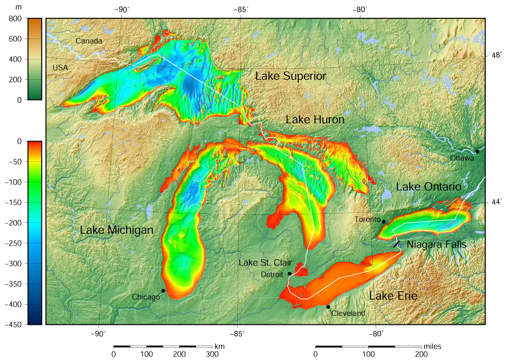
- The Great Lakes, also called the Great Lakes of North America or the Laurentian Great Lakes, are a series of large interconnected freshwater lakes with certain sea-like characteristics in the mid-east region of North America that connect to the Atlantic Ocean via the Saint Lawrence River.
Project
- Draw one of the Great Lakes, perhaps one near your home or one you have visited.
- Overview
- Map and Diagrams


Location

| Located in | Eastern North America |
Fun Facts
- Though the five lakes lie in separate basins, they form a single, naturally interconnected body of fresh water, within the Great Lakes Basin.
- The lakes drain a large watershed via many rivers and contain approximately 35,000 islands.
- There are also several thousand smaller lakes, often called “inland lakes”, within the basin.
- It is thought the Great Lakes formed through the actions of massive glaciers, and the valleys they carved filled with meltwater from the retreating ice sheets.
Past Lessons
| 42 | October 24, 2022 | (North America) |
| 207 | July 21, 2026 | (North America) |