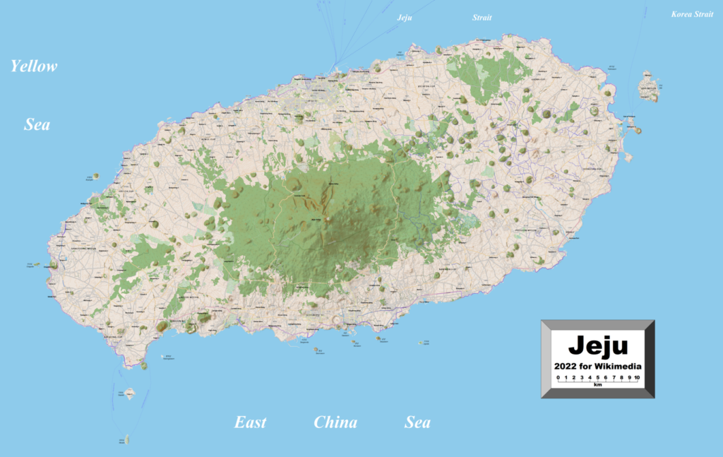
Jeju Island is a volcanic island, which means it was formed by volcanoes! Millions of years ago, hot melted rock called magma erupted from deep inside the Earth and cooled to form the island’s land. You can still see signs of this volcanic history today, like the tall mountain called Mt. Halla or Hallasan, which is actually an extinct volcano. There are also many smaller volcanic cones and lava tubes scattered across the island, reminding us of the powerful forces that shaped this beautiful place.
Project
Draw one of the places we’ve learned about on Jeju Island.
Jeju has amazing lava tubes! These are like tunnels made when hot melted rock (lava) flowed underground and then cooled.
There are many smaller volcanoes called “oreum” all over the island. They look like little hills.
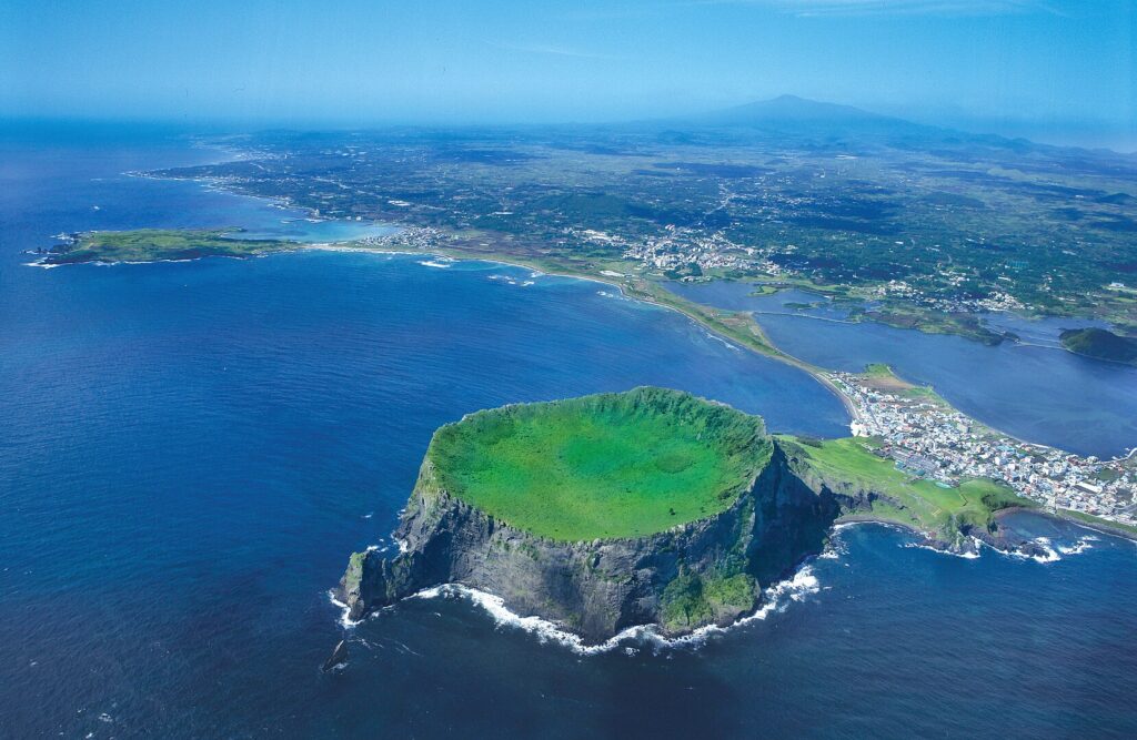
Seongsan Ilchulbong is a special volcanic cone that looks like a giant castle rising from the sea.
Because of its amazing volcanic features, Jeju Island is a UNESCO World Heritage Site.
Past Lessons
146
January 27, 2025
(North America)
No Past Lessons
Upcoming Lessons
No Upcoming Lessons
We use cookies to ensure that we give you the best experience on our website. If you continue to use this site we will assume that you are happy with it.Ok